TO HOME PAGE - WOODLANDS HISTORIC PARK UNOFFICIAL SITE
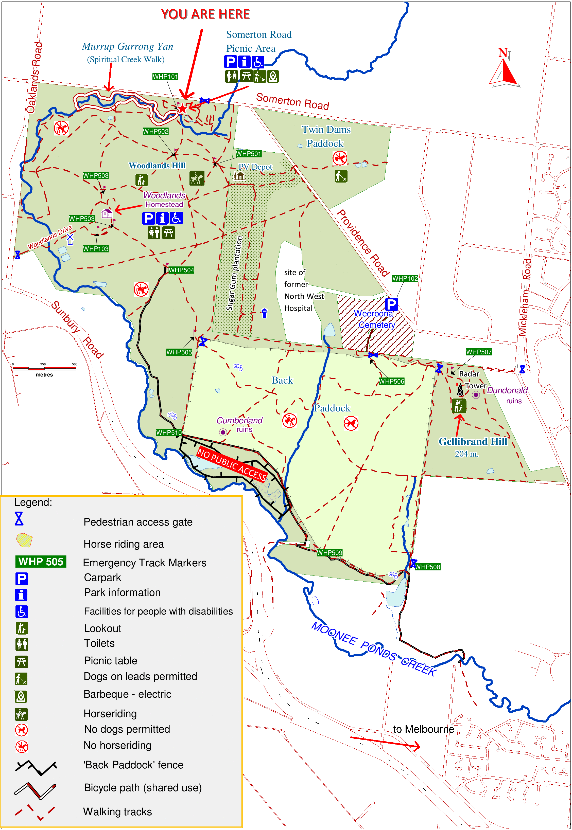
This map was prepared by a Parks Victoria staff member for the information shelter at the Somerton Road car park, hence the "You Are Here" arrow.
Other maps on this site:
| Clickable Satellite Map | Links to pages describing the vegetation and land use history of the park and some adjacent areas. |
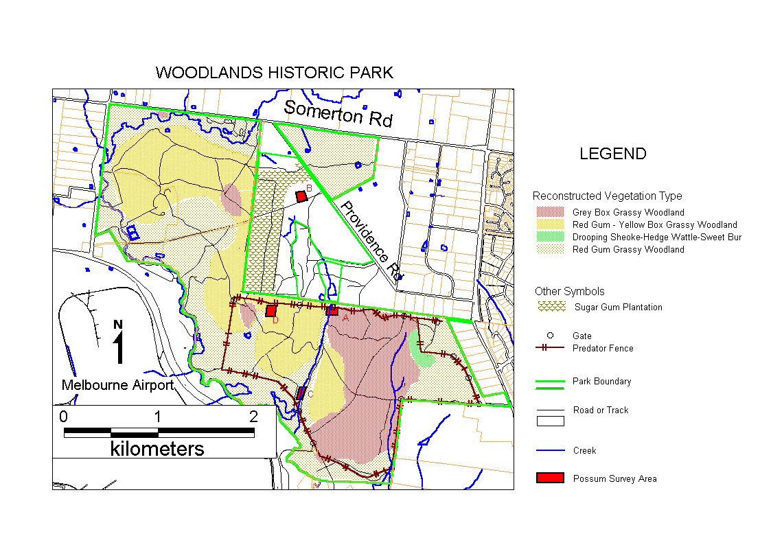
| Historical Vegetation Map | A reconstruction of the vegetation types which existed before European Invasion |
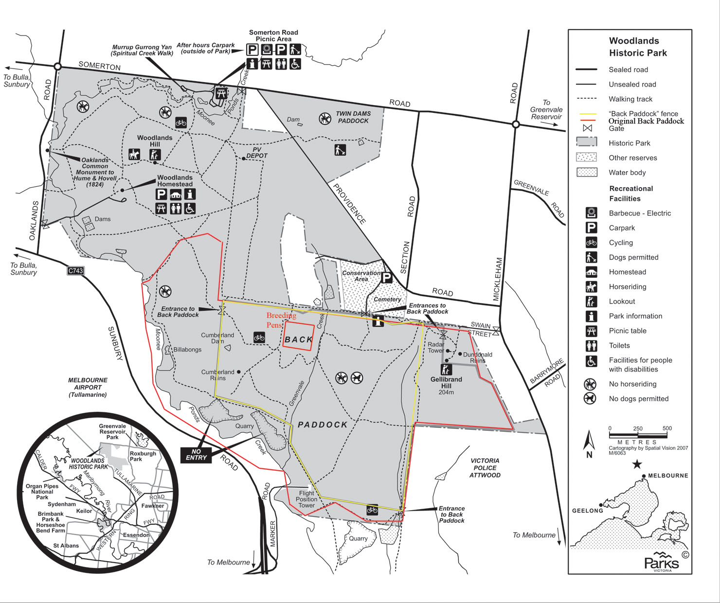
| Back Paddock History Map | Shows the original and current extent of the Back Paddock |