On these pages I plan to give a general description of different sections of the park, particularly the vegetation including weeds. (It will be very far from a botanical survey however.) I will also mention some other management issues such as rabbits, erosion and access. Only common names of plants are used, scientific names can be found in the species list.
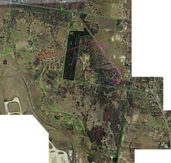
Select a section by clicking within the green outlines on the Satellite Photo Map, or from the list below. Note that the numbering is arbitrary. The map is quite large and you may need to scroll to see all parts of the park. You can also use the buttons to zoom in and out.
Tracks are not explicitly shown on the map, although most of them are visible on the Satellite photograph. For the official tracks see this map.
- 1. Twin Dams Paddock
- 2. Depot Paddock
- 3. Former Greenvale Sanatorium Land (excluding Sugar Gum Plantation)
- 4. Sugar Gum Plantation (Greenvale Sanatorium Land)
- 5. Sanatorium Dam Area
- 6. Gellibrand Hill
- 7. Back Paddock
- 8. Former Back Paddock on Factors Land
- 9. Former Back Paddock on Woodlands Property
- 10. Quarries
- 11. Homestead and Leased Paddocks
- 12. Picnic Ground and "Conservation Zone
- 13. The Creek (not clickable on map)